AGRICULTURE
Adaptable & Extensible Spatial Solutions for High-Precision Agriculture.
AgriPort
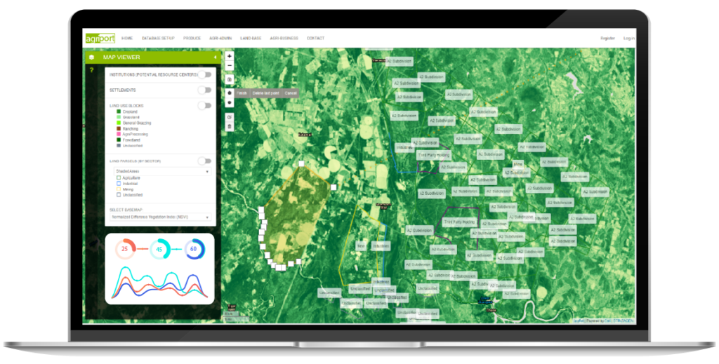
AgriPort is INNOVEDGE’s spatial platform to manage the agriculture sector within a country. The system consists of a scalable central geodatabase to capture land zoning and use, production data, markets information, livestock tracking and more. Users can also access data on weather, soil, moisture and vegetative indexing high resolution imagery over their areas of interest.
Governments and sector authorities can use our solution to manage subsidies, distribution of resources, support policy formulation and implementation.
Contract farming suppliers and financiers can use the platform to keep track of activities, needs and productivity of their contractors.
Farmers can use the platform to manage their operations, log their activities, request services online and access data and information needed to plant effectively.
Agribusiness firms can use it to access information on produce, farmer performances and investment opportunities etc.
Contact us today to request a demo or find out how you can be part of it.
Integrated Services
INNOVEDGE provides specialised ICT, GIS and Spatial Intelligence services for the agricultural sector that include: